
CEDAR CITY – The Gap Fire, as it has been named, which began Friday at 3:07 p.m. as a result of a lightning strike 20 miles north of Cedar City is reported at 25 percent contained this morning with minimal fire activity at 11:20 a.m. The fire remains estimated at 150 acres, fueled by pinyon, juniper, cheatgrass and brush. See update below.
Crews are taking advantage of the higher relative humidity and reduced wind conditions this morning, Bureau of Land Management’s fire mitigation and education specialist, Nick Howell, said, before changing weather conditions can negatively influence fire behavior today.
Minersville, the closest community to the Gap Fire, is probably not going to be threatened, Howell said. No communities are currently threatened, no evacuations or road closures are in effect, no injuries reported.
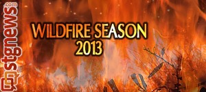
Southern Utah wildfires 2013
Lightning bolts started 10 fires in Southern Utah’s five-county region Friday, Howell said, and 70 fires thus far this season.
Some are smaller fires and not posted on the Utah Fire Information website.
“Some are just one tree,” Howell said with reference to yesterday’s 10 starts. “One was 1.5 acres, one was 20 acres in the same area as the Gap Fire.”
Color Country Interagency fire response teams were able to staff all of yesterday’s fires but resources are spread pretty thin, Howell said.
Although some agencies have been affected by the nation’s sequestration cutbacks, Howell said that BLM has not been affected in its suppression force.
“We had some challenges last year – we didn’t hire any firefighters;” Howell said, but “the good news is we have more aircraft this year than last year.”
Howell said it looks like there will be more buildup and thunderstorm activity today which may result in more lightning starts. A Red Flag Warning has been issued for the region by the National Weather Service in Salt Lake City through 9 p.m. today, forecasting dry thunderstorms and gusty outflow winds which, combined with the heat and dry conditions make for critical fire weather potential.
The Gap Fire updates:
June 29, 2013 3:30 p.m. The Gap Fire now covers approximately 881 acres; though it has grown it is now 50 percent contained. Resources applied include six fire engines, two hand crews, one squad, two dozers and various overhead. Approximately 90 personnel are assigned to the fire.
June 29, 2013 8 p.m. The Gap Fire is now 100 percent contained at 881 acres. Interagency crews will remain on scene tomorrow to secure remaining hot spots. No injuries have been reported. This is the final update unless significant changes occur.
Email: [email protected]
Twitter: @JoyceKuzmanic
Copyright St. George News, SaintGeorgeUtah.com LLC, 2013, all rights reserved.
Utah Fire Information Website link is not working…
Not working for me, either. That one would be good to bookmark for the next few months…
The link has been repaired. Thank you for bringing it to our attention.
Alexa Verdugo Morgan
STGnews Assistant Editor
Works great now, go it bookmarked. Thanks!
In 4 hours it grew by 730 acres…or did I read something wrong. If I were in Minersville, I’d be packing. How can they call that ‘contained’ at all?
Hi San, you did not read it wrong, but I may be able to shed some light on fire jargon and reporting.
When we spoke with Nick Howell this morning we talked about gps mapping, he was not able to say when gps mapping would be done or if it would be done today – it had not been done at that point. So growth from 150 acres to 881 acres does not necessarily mean that it occurred during the interval between updates, but since the first appraisal of 150 acres Friday.
As for containment, Fire Information Officer Mark Wilkening explained the concept to us last year during the Shingle Fire. From that report:
“The fire needs to go through what is called a ‘burning period’ before they are comfortable claiming containment percentages. “’Zero doesn’t mean we don’t have control lines already in,’ he said, ‘it just means it hasn’t gone through the burning period so that we are comfortable saying (the lines) are holding.’
“The highest temperatures combined with the lowest humdities constitute a burning period. This usually occurs in late afternoon, but not necessarily so. Fine fuels start the fire (dry lightweight materials, pine needles, for example), heavier fuels sustain the fire (branches, for example), and even heavier fuels drive the fire (tree trunks, for example).”
Containment and “out” are not the same thing.
I hope that helps some?
ST. GEORGE NEWS | STGnews.com
Joyce Kuzmanic
EIC