SOUTHERN UTAH — The National Weather Service has issued a “Red Flag Warning” for much of Washington, Iron and Kane counties for dry thunderstorms and gusty outflow winds. This is a critical fire conditions alert and is in effect from noon to 10 p.m. Wednesday.
Affected area
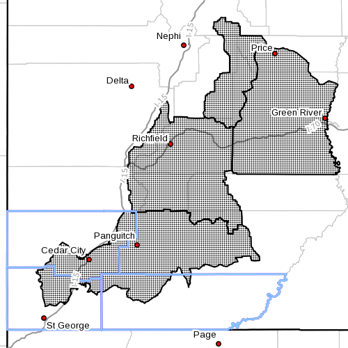
Fire weather zones 488, Manti National Forest, 489, San Rafael Swell, 493, Central Utah Mountains, and 496, Color Country mountains (see map insert).
Thunderstorms
Thunderstorms will develop Wednesday afternoon. Storms will initially develop over the higher terrain and will move over adjacent valleys. Most thunderstorms will be dry, though some storms may be accompanied by wetting rain. Regardless, lightning will result in new fire starts.
Outflow winds
Outflow winds will be gusty and erratic in the vicinity of thunderstorms and may cause unpredictable fire behavior.
Impacts
Dry thunderstorms in an area with dry fuels will create hazardous fire weather conditions and likely result in new fire starts Wednesday.
Precautionary/ preparedness actions
A “Red Flag Warning” means that critical fire weather conditions are either occurring now or will shortly.
A combination of strong winds, low relative humidity and warm temperatures can contribute to extreme fire behavior.
Related posts
-
Fireworks banned in most areas, 2014 restrictions guide
-
Fire restrictions expanding across southwest Utah, northwest Arizona
Email: [email protected]
Twitter: @STGnews