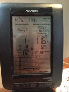
ST. GEORGE – The National Weather Service out of Salt Lake City has issued a “Hazardous Weather Outlook” for the western two-thirds of Utah and southwest Wyoming for high temperatures 10 to 15 degrees above normal and an elevated threat of heat related stress.
Hot temperatures are expected across the outlook area Saturday with many valleys seeing readings near or above 100. Highs around 110 are forecast for the St. George area.

Remain alert to the hazards of excessive heat. The added stress can be dangerous, particularly for sensitive individuals.
Days two through seven, Sunday through Friday
The hot temperatures are expected to continue across most of the outlook area through the week with highs each day averaging 10 to 15 degrees above normal. This long stretch of hot weather will maintain an elevated threat of heat related stress.
The National Weather Service is advising those who work or spend time outside to take extra precautions. When possible, reschedule strenuous activities to early morning or evening. Know the signs and symptoms of heat exhaustion and heat stroke. Wear lightweight and loose fitting clothing when possible and drink plenty of water.
READ MORE: Did you forget something? Don’t make this deadly summertime mistake
To reduce risk during outdoor work, the Occupational Safety and Health Administration recommends scheduling frequent rest breaks in shaded or air conditioned environments.
“Anyone overcome by heat should be moved to a cool and shaded location,” according to the weather service. “Heat stroke is an emergency, call 911.”
The maximum high temperature for Utah was recorded on July 5, 1985 in St. George when temperatures reached 117 degrees, according to the National Centers for Environmental Information State Climate Extremes Committee.
A 118 degree temperature was observed on July 4, 2007 at a Remote Automated Weather Station located near the Utah Welcome Center on Interstate 15 in St. George. However, a decision on the validity of this value has not yet been reached by the State Climate Committee.
Areas most affected
Cache Valley/Utah portion, northern and southern Wasatch Front, Salt Lake and Tooele valleys, Great Salt Lake Desert and mountains, Wasatch Mountain valleys, Wasatch mountains north and south of I-80, western Uinta Mountains, Wasatch Plateau/Book Cliffs, western Uinta Basin, Castle Country, San Rafael Swell, Sanpete/Sevier Valleys, west central and south central Utah, southwest Utah, Utah’s Dixie and Zion National Park, Glen Canyon Recreation Area/Lake Powell, central and southern mountains and southwest Wyoming.
Related posts
- Excessive heat warning issued as record high temperatures approach
- Did you forget something? Don’t make this deadly summertime mistake
- Nobody thinks it will happen, until it does; 20th child dies from vehicular heat stroke, 2014
Email: [email protected]
Twitter: @STGnews
Copyright St. George News, SaintGeorgeUtah.com LLC, 2015, all rights reserved.