ST. GEORGE – The National Weather Service’s hazardous weather outlook in effect Saturday through Friday for the western two-thirds of Utah and southwest Wyoming foresees rain and snow largely in the northern region worthy of motorist precautions while forecasting continuing higher than normal mid-December temperatures in the South.
Southern Utah
Southern Utah will miss out on most of the precipitation Saturday with temperatures across the south remaining above mid-December norms, especially across southwest and west-central Utah.
Light precipitation could reach into west-central Utah overnight Saturday and into Sunday with minimal impacts expected.
Utah Department of Transportation forecasts light snow Sunday on state Routes 153, 24, 72 and 132 with possible slush on SR-24 and SR-132.
Northern Utah and southwest Wyoming
Light valley rain and mountain snow early morning Saturday across far northern Utah will spread south and increase in intensity across northern Utah and southwest Wyoming.
Utah Department of Transportation is requiring chains or four-wheel drive for all vehicles in Big and Little Cottonwood Canyons.
Heavy snows will return to the northern mountains later Saturday and continue heavy at times Saturday night. Several inches of new accumulation are expected in the mountains with the greatest amounts for the Wasatch range.
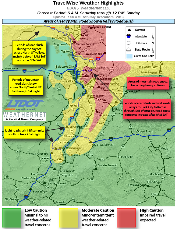
Significant travel impacts at the higher elevations are anticipated through the overnight hours.
Valley locations will see rain today Saturday though a few areas of the far north could see brief periods of snow or a rain and snow mix Saturday morning.
Colder air returning to far northern Utah Saturday night will change some of the rain back to snow before Sunday morning.
UDOT road alerts for Saturday
According to UDOT, routes listed below will experience weather-related travel concerns Saturday.
- I-15, Idaho border to Brigham City; Payson to Nephi; Scipio Summit; Cove Fort at the Interstate 70 junction.
- I-80, Parleys Canyon to the Wyoming border.
- I-70, Cove Fort at the I-15 junction to Sevier; Salina Canyon to Ivie Creek Summit
- I-84, Idaho border to Tremonton; Uintah junction at U.S. 89 to Echo.
- U.S. 89, Idaho border to Brigham City to Farmington; Thistle at the junction of U.S. Highway 6 through Mt. Pleasant.
- U.S. 40, Silver Creek junction at Interstate 80 across Daniel’s Canyon to Starvation Reservoir.
- U.S. 191, Wyoming border to Vernal; Indian Canyon to Castle Gate.
- U.S. 6, Eureka to Santaquin; Spanish Fork to Soldier Summit to Helper.
- U.S. 189, Provo Canyon.
For more specific information on roads and highways see UDOT’s road weather alert webpage.
Sunday through Tuesday
Showers lingering primarily over the mountains early Sunday will end in most areas by late Sunday afternoon. Steady light precipitation will persist across far northern Utah and southwest Wyoming Sunday night into Monday.
Precipitation will retreat north of the outlook area Monday night through early Tuesday as high pressure moves east across the Great Basin.
The next round of rain and snow will reach the northern half of the outlook area late Tuesday then persist through the middle portions of the week.
Widespread snow and much colder temperatures will arrive late in the week as a cold pacific storm system enters the region.
Email: [email protected]
Twitter: @STGnews
Copyright St. George News, SaintGeorgeUtah.com LLC, 2016, all rights reserved.
Just be careful out there folks. give yourself some extra time to get to your destination. Slow down and be safe and enjoy the wonderful festivities of the holiday season and the celebrations