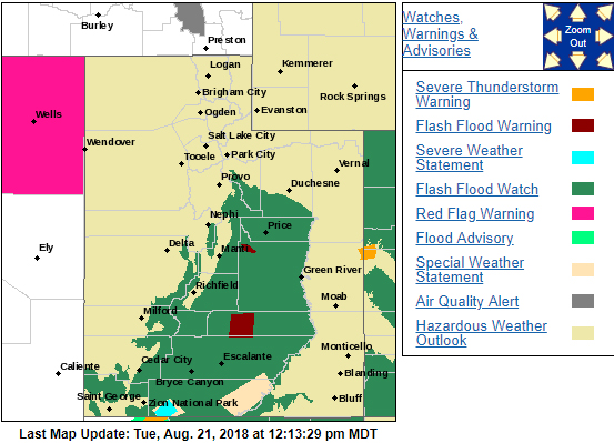
ST. GEORGE — The National Weather Service issued a flash flood warning Tuesday afternoon for parts of Garfield and Wayne counties. This warning comes on top of a flash flood watch for most of Southern Utah that was issued early Tuesday morning.
Flash flood warning
At noon Tuesday, Doppler radar indicated a thunderstorm producing heavy rain over Capitol Reef National Park and estimated up to .8 inches of rain had fallen in less than an hour. Flash flooding was expected to begin shortly in the Freemont River and Deep Creek basins.
The flash flood warning is in effect until 3 p.m.
Flash flood watch
The National Weather Service issued the flash flood watch for much of the area east of Interstate 15 and south of Highway 40. This includes Zion National Park, Capitol Reef National Park and Glen Canyon Recreation Area and will run from noon Tuesday through 10 p.m.
Numerous showers and thunderstorms are forecast to develop along the spine of the mountains and across the eastern Utah valleys today. This activity has the potential to bring heavy rainfall.
Flash flooding is a significant concern near burn scars, slick rock, slot canyons and normally dry washes. Flooding and debris flows may impact travel.
Read more: What to do before, during, after a flash flood
Email: [email protected]
Twitter: @STGnews
Copyright St. George News, SaintGeorgeUtah.com LLC, 2018, all rights reserved.